TJOLOTJO
By Gordon Poultney 1987
Rhodesian Place Names
TJOLOTJO
By Gordon Poultney 1987
Latitude 19° 30' S, Longitude 27° 25' E, Altitude 1,100 m (3,630 ft.), Rainfall
604 mm (20 inches)
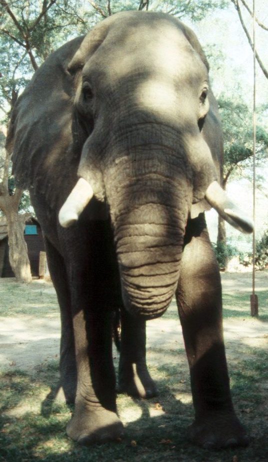
Tjolotjo is a Bushman word meaning the head of an elephant. The area was
originally inhabited by the Maswara bushmen who were not true bushmen but a
mixture of the bushmen and the local tribes. Tjolotjo received its name during
the trek into Matabeleland by Mzilikazi as he led his nation from the south in
search of new pastures and lands for his people as they fled from the Boers in
the Transvaal. The area was a favourite of the elephant herds that had attracted
the early ivory hunters and were still to be found in abundance when the
Matabele arrived in 1838.
Tjolotjo is situated about 65 kilometres west of
Nyamandhlovu in the Gwaai Tribal Trust land. It has been an administrative
centre for the trust land for many years and fell under the jurisdiction of the
Native Commissioner for Nyamandhlovu who first assumed responsibility in 1909.
Prior to this date the area fell under the jurisdiction of the Superintendent of
Natives at Bulawayo.
The village is linked to Plumtree by a dirt road and other roads lead through
very heavy Kalahari sands (Gusu) into the Gwaai Tribal areas and beyond into the
forest reserves. The soils around the precincts of the village comprises of
regosols derived from Kalahari sands and shallow rocky basalt-derived pockets
are to be found in the district. There is a belt of alluvium along the Gwaai
river which has led numerous prospectors in the search of minerals and precious
and semi-precious stones. An industrial school was founded at Tjolotjo in 1921
by H. S. Keigwin, who also had a hand in establishing a similar institution at
Domboshawa the following year. The original course was designed by E. D. Alvord,
who was then an agricultural missionary at Mount Selinda, where he had started
instructing African students on similar lines in 1920. The school was moved to
Essexvale between the years 1941 and 1944 and
renamed 'Esigodini'. It is fitting that Mr. Alvord's son D. L. Alvord should
have been appointed the principal of the college.
After the college was transferred to Essexvale, the vacated land was used as an
experimental substation of the Matopos Research station, where the work is
primarily concerned with the breeding of indigenous Nkone or 'manguni' cattle.
These animals which originally came from Swaziland and Zululand, were brought by
the Matabele during their northward migrations during the first half of the 19th
century. These cattle are believed to have originated from a shorthorn-sanga
cross. The name sanga was applied to the giant horned cattle of Abyssinia. The
head and horns form the principal conformational features by which the breed is
identified; their most characteristic feature when mature, being the lyre-shape.
The Gwaai and Manziyama rivers are the principal rivers in the area, but usually
only flow during the rains.
Related web site :
Beloved African - a book
about African education at Tjolojo and subsequently in Essexvale, as mentioned
above.
Return to Rhodesian Place Names
Most of the information on this page is
extracted from the books :
"Avondale to Zimbabwe" written and published by R.
Cherer Smith ISBN 0-7974-0313-2 and
"Tabex Encyclopedia Zimbabwe" © Quest Publishing
ISBN 0-908306-04-0
with additional notes and photographs by the webmaster and other
contributors as acknowledged.